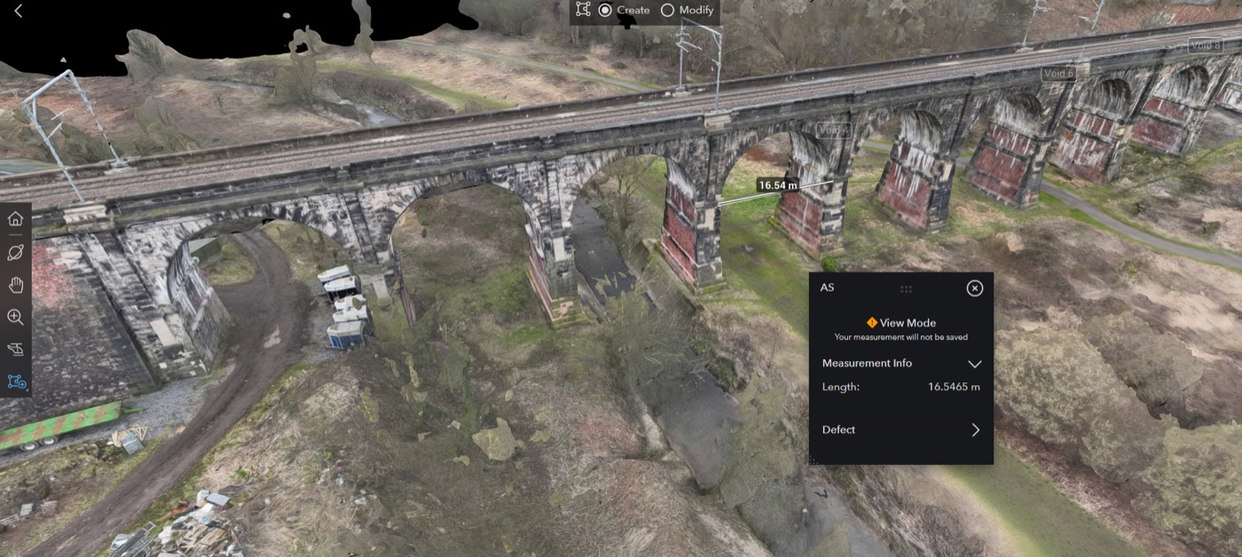
What This Proves
- More than 15km captured using drone LiDAR, orthophotography, and 360 imagery.
- Hydrological features and drainage paths mapped for maintenance planning.
- GIS/BIM-ready archive created while reducing track-access time.
Case Study
Corridor survey and floodplain mapping to inform drainage, resilience, and asset-risk decisions across a vulnerable rail route.
This project is evidence for digital twins, multidisciplinary delivery and practical client-ready reporting.
Explore digital twinsReference this case study when you contact Ishtar so the enquiry starts from the right technical route.
Start an enquiryNeed a similar project route, review, survey, assessment, facility plan or delivery pack?
View all case studies